The UK’s pothole problem, and why reporting precise locations matters


Potholes remain a daily frustration on UK roads, from city streets to rural lanes. They cause breakdowns, costly repairs, and safety risks for drivers and cyclists. Councils are working hard to keep up, so making every pothole report as easy to find as possible is a simple yet effective way to make a real difference.
The scale of the UK’s pothole problem
Recent AA, RAC and government figures show just how common pothole damage remains for UK road users. Even with increased investment in road maintenance, the backlog is large and highly visible to anyone who drives or cycles regularly.
- The RAC estimates drivers have to battle against at least one million potholes on the country’s roads (with the number varying from season to season).
- Over the 12 months to the end of September 2025, RAC data shows 25,758 pothole-related breakdowns – an 11% rise on the previous year, or around 71 a day.
- New AA figures for 2025 show 613,638 pothole-related callouts , averaging 1,681 incidents every day across the UK.
- The AA estimates the average repair cost per pothole incident in 2025 was £350 , adding up to around £215 million per year for AA members, or £645 million when scaled to cover all UK drivers
At the end of 2025, the UK government announced a record £7.3 billion boost for local roads in England, describing it as the “biggest ever investment in local roads”, with funding expected to fix millions of potholes each year and improve road surfaces nationwide.
This funding helps, but speed and efficiency still depend on actionable information, especially when crews are dealing with high volumes of reports and limited time on the ground.
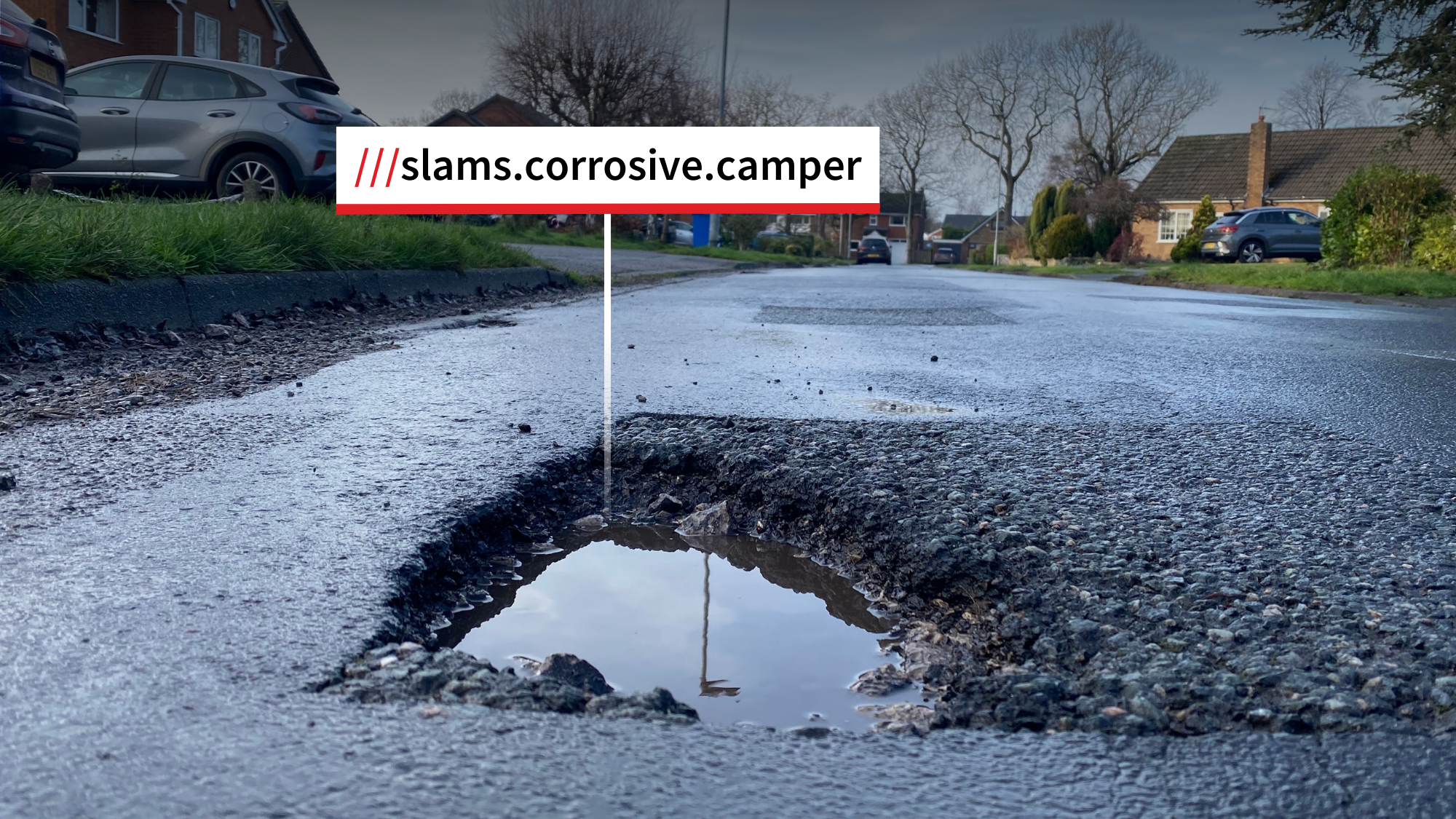
Why exact pothole locations matter
Even when someone takes the time to report a pothole, it can still be surprisingly difficult for crews to find the exact spot described. Most potholes are small, hard to spot from a distance or moving vehicle, and often sit on long stretches of road with few distinctive landmarks. For example:
- A single postcode can cover a long main road plus several side streets, leaving inspectors to drive up and down looking for one crater in the tarmac.
- On rural roads, dual carriageways or roundabouts, there may be no buildings or obvious reference points at all, and sharing a dropped pin or grid reference over the phone is not always straightforward.
-
If crews can’t find the reported defect straight away, they may have to revisit, ask for more information, or risk leaving it unresolved for longer than anyone would like.
For drivers and riders, the impact is felt in repair bills, lost time and, in some cases, safety risks. For councils, unclear locations can mean wasted journeys, slower triage and delayed fixes – exactly the issues maintenance teams are trying to reduce.
How councils are using what3words
what3words has divided the world into a grid of 3m squares and assigned each one a unique combination of three words: a what3words address. This means every pothole, fallen tree and road defect has its own what3words address. The simple system makes it easier for anyone to share the exact location of a pothole so it can be easily found and fixed.
More than 100 councils across the UK now use what3words in their operations, from incident reporting to asset management. Several highlight the benefits for pothole reporting and road maintenance in particular:
-
Essex County Council
- “We have integrated what3words into our public reporting tool, allowing residents to provide accurate location information for issues such as potholes or on public rights of way where an internet connection is not always available in a rural area.” – Will Young, Innovation & Efficiency Manager at Essex County Council
-
Cumbria County Council
- “Residents can use what3words to communicate pothole locations so that our Highways Teams can focus on the repairs in a streamlined manner.” – Cumbria County Council on Times & Star
-
Swansea County Council
- Swansea County Council has added what3words to its online platform for reporting potholes. By accepting what3words addresses, residents can now report potholes and provide highly accurate location information in a more user-friendly manner. The council can then quickly dispatch maintenance crews to the precise location to fix the issue.
Making pothole reports more useful for everyone
Everyone who uses UK roads can play a part in making pothole reports more effective. Adding a precise location aids councils to turn each report into a faster, more targeted response and helps crews spend less time searching and more time repairing.